A large group of ANSTO environmental scientists and collaborators have produced the first groundwater stable isotopes, ‘isoscapes’, intuitive maps with grid data, across NSW combining new and pre-existing isotope measurements.
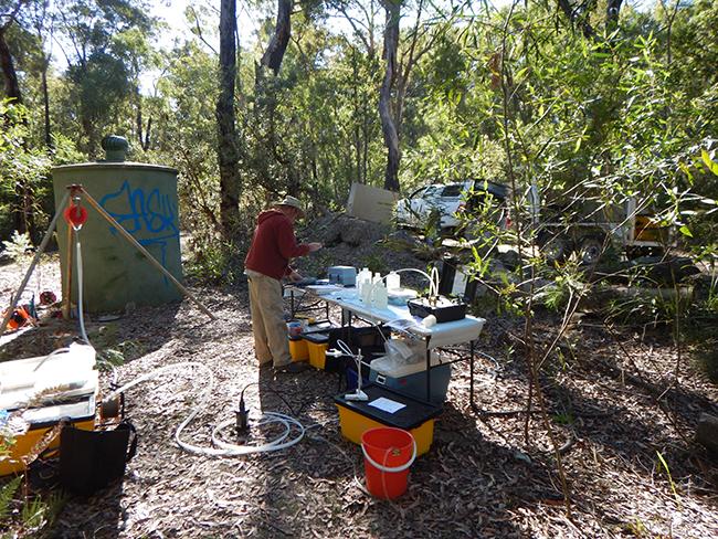
The first isoscapes developed in Australia have been published in a study in the Journal of Hydrology: Regional Studies is the result of funding and collaboration between ANSTO, the NSW Department of Climate Change, Energy, the Environment and Water and the National Water Grid Authority. Approximately 1,000 groundwater samples were collected across NSW and analysed in the Environment laboratories at ANSTO.
Stable isotope ratios of water (δ2 H and δ18O) can be used to trace hydrological processes, providing information on aquifer dynamics including groundwater recharge, flow and mixing.
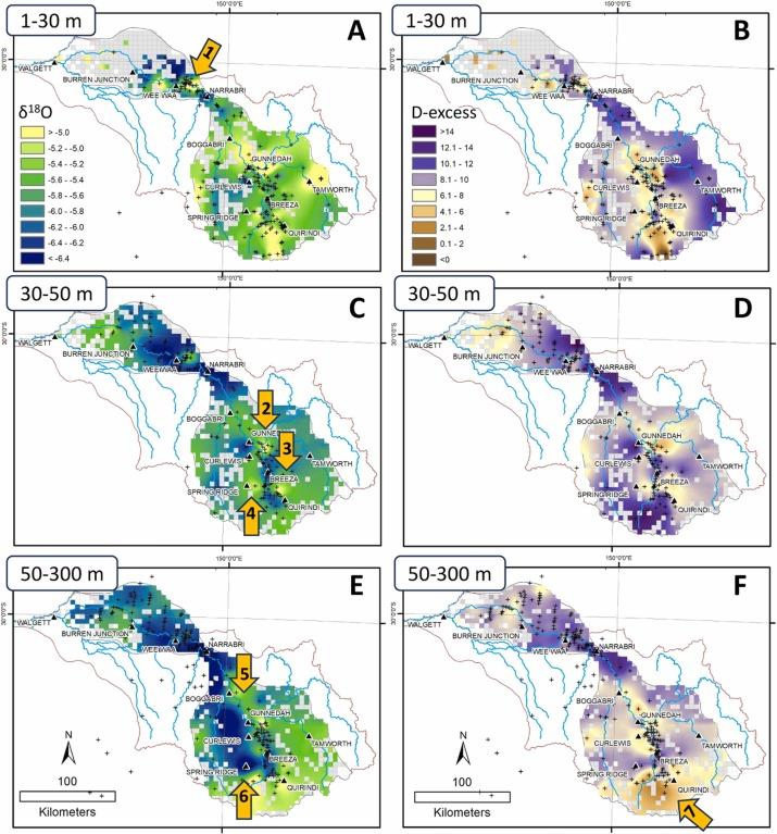
The isoscapes show the sources of water and the processes affecting groundwater recharge. Collection of water samples at different depths. from surface down to 1000 reveal a kind of “isotope radiography” of groundwater.
Results showed the effects of land use practices over the last 200 years, demonstrate the importance of river corridors, floods and snow melt in recharging our large alluvial systems and highlight the effects of past climates on groundwater recharge.
This high-resolution map highlights where older, deeper groundwater is mixing with shallower alluvial systems. It also identifies areas where surface water storage and evaporation are influencing deeper groundwater.
Additionally, the detailed catchment scale data can be used to inform local water sharing plans. This can be expanded as more data density is available through the state.
“This is only the first of a series of results from the analysis done during the project. Our team is interpreting data from other isotope tracers including tritium, radiocarbon and chlorine-36 in groundwater that, together with the published data, will help in management of groundwater resources state-wide,” said project lead Dr Dioni Cendón.
Contributors from the Environment Research and Technology Group included Dr Cendón, Mr Stuart Hankin, Dr Jagoda Crawford, Dr Liza McDonough, Dr Catherine Hughes and Dr Karina T. Meredith.
Collaborating research organisations included UNSW Sydney, CSIRO Environment, Australian Department of Climate Change, Energy, Environment and Water NSW, and the ANU Research School of Earth Sciences, Australia.
ANSTO previously reported highlights from this research in an article.
DOI: https://doi.org/10.1016/j.ejrh.2025.102732